Contents
Parthava (Parthia)
|
Region & People
Related reading:
Location and Extent of Parthava (Parthia)
Parthava was located in what is today the border region between north-eastern Iran and south-western Turkmenistan. The original Parthava was a relatively small kingdom less than 200 km in length and perhaps about 40 km in width. As the successor kingdom to Nisaya, it was called Nisaya-Parthava or Parthau-nisa by Western writers. Parthau-nisa was in turn primarily located for the main part in today's Turkmenistan along the lower slopes of the Kopet Dag mountains. According to classical writer Isidorus Characenus who we quote further below, Parthaunisa had three cities spaced about 40 km apart and one village.
Following the Parthava's (Parthian's) assertion of their independence from the Macedonians, the heartland of Parthia appears to have grown in size to include what is today the northern Khorasan region of Iran.
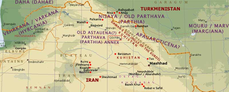 |
Map of Ancient Parthava (Parthia) & Modern Khorasan, Iran.
Base map credit: Microsoft Encarta |
Account of Isidorus Characenus (Isidore of Charax)
Isidorus Characenus (Isidore of Charax), a little known writer who listed the caravanserai maintained by the Parthian government, isi gives us a contemporaneous (c 29 to 1 BCE, 250 years after the start of Parthian rule) description of the locations and extent of Parthava in his Parthian Stations. In the sections regarding Parthava and its neighbours Varkana (Hyrcania), and Mouru (Merv) he states:
"Beyond is Hyrcania [Varkana], 60 schoeni [360-480 km, the length*], in which there are 11 villages in which there are stations [caravanserai]."
[*These are not straight-line distances, but distances travelled by road. A schoenus is based on the Persian Parasang (Farsang), 6-8 km.]
"Beyond is Astauena [later South Parthava?], 60 schoeni [360-480 km, the length], in which there are 12 villages in which there are stations [caravanserai]; and the city of Asaak (also Assac), in which Arsaces was first proclaimed king; and an everlasting fire is guarded there." [Isidorus is travelling east from Hyrcania to Astauena and then north to Parthyena. Astauena district appears to be located in the southern Kopet Dag hills. From Astauena he appears to have travelled north to the foot of the northern Kopet Dag hills.]
"Beyond is Parthyena [Parthava / Parthia], 25 schoeni [150-200 km, the length]; within which is a valley, and the city of Parthaunisa after 6 schoeni [36-48 km]; there are royal tombs. But the Greeks call it Nisaea. Then the city of Gathar after 6 schoeni[36-48 km]. Then the city of Siroc after 5 schoeni[36-40 km]. Of villages it has no more than one, which is called Saphri." [The part of Parthava heartland that Isidorus appears to describe is a relatively narrow stretch of land about 40 km wide and up to 200 km long - along the north-eastern Kopet Dag mountains. Leaving Parthava, Isidorus continues his travel-route eastward along the northern base of the Kopet Dag (Koppeh Dagh, Kapeh Dag) mountains. Today, the Kopet Dag mountains form the border between Iran and Turkmenistan]
"Beyond is Apauarcticena [a district between Parthava and Mouru (Nisa and Merv) i.e. the Tejen / Tajend / Tedzhen river delta or perhaps returning back to the Kopet Dag highlands (say north of Mashhad, the highlands opposite the Tajend delta), traversing west to east in a zigzag manner], 27 schoeni [162-216 km], in which is the city of Apauarctica. Then the city of Ragau and two villages."
"Beyond is Margiana [Mouru, Merv], 30 schoeni [180-240 km]. There is Antiochia [the principal city?], called well-watered; but there are no villages. [If this description is correct, then Mouru appears to have been a city state.]"
By Isidorus' account, ancient Nisa / old Parthava (Parthia) would have extended for 150-200 km along the northern slopes of the Kopet Dag (Koppeh Dagh, Kapeh Dag) mountains, a relatively small kingdom. A similarly small kingdom, Mouru lay at the eastern end of the Kopet Dag. Today, we find that the northern foothills of the Kopet Dag are scattered with the ruins of an ancient civilization, some yet to be explored methodically.
Marcus Justinus on Parthian Expansion
Marcus Justinus jus in 41.1 states: "The Parthians, ...gradually settled in the deserts betwixt Hyrcania (Varkana), the Dahae (Dahi/Daha), the Arei (Aria), the Sparni(?) and Marsiani (? Margiana). They then advanced their borders, though their neighbours, who at first made no opposition, at length endeavoured to prevent them, to such an extent, that they not only got possession of the vast level plains, but also of steep hills, and heights of the mountains; and hence it is that an excess of heat or cold prevails in most parts of the Parthian territories; since the snow is troublesome on the higher grounds, and the heat in the plains."
Strabo on Old Parthia & Parthian Expansion
Strabo (c 63/64 BCE - 24 ACE) author of Geography str is famously quoted by authors who base a number of their conclusions on his work. In 11.9.1 he states, "As for the Parthian country, it is not a large country; for this reason it was united with the Hyrcania (Varkana) for the purpose of paying tribute under the Persian dominion."
Strabo goes on to decsribe old Parthava. "In addition to its smallness, it is thickly wooded and mountainous, producing nothing; so that the kings with their multitude of followers pass with great speed through the country, as it is unable to furnish subsistence for such numbers even for a short time." Strabo's account is confusing. He lived during Parthian times and around the same time as Isidorus Characenus. The latter part of this statement - that it is "thickly wooded and mountainous, producing nothing" contradicts other accounts. The significant part of Parthava (Parthia), the Nisa plains and the Kopet Dag valleys, were farmland and orchards. Where in the rain shadow, land suitable for agriculture was watered by ancient canals. Indeed, Parthava's slopes can be considered the cradle of civilization where farming techniques first developed. Strabo says nothing of this. The wooded, hilly parts were quite narrow and easily crossed. The hills are far less formidable and inhospitable than the mountains and deserts elsewhere in the Iranian-Aryan lands. The country was small by Strabo's own account.
Strabo str 11.9.1 on Parthian expansion:: "At present, however, it (Parthia) has increased in extent. Parts of the Parthian country are Comisene [Kumes / Kumis / Qumes?] and Chorene [both in north-western Khorasan?], and, one may almost say, the whole region that extends as far as the Caspian Gates and Rhagae [Tehran] and the Tapyri], which formerly belonged to Media [eastern Media." [This appears to describe the territory covering northern Khorasan and Semnan provinces as well as all of Tehran province today. Traditional Mada (Media) territory would have extended at least 90 km east past Rhagae / Tehran.]
Strabo 11.9.1 contd.: "And in the neighbourhood of Rhagae are the cities Apameia and Heracleia. The distance from the Caspian Gates (see below) to Rhagae is five hundred stadia* (93 km), as Apollodorus says, and to Hecatompylos, the royal seat of the Parthians, one thousand two hundred and sixty (235 km)." Strabo also notes in 11.13.6 that, "Greater Media is bounded on the east by Parthia and the mountains of the Cossaei."
[*A stadia, the length of a stadium, is about 187 m, say rounded at 200 m or .2 km.]
Region & Environment
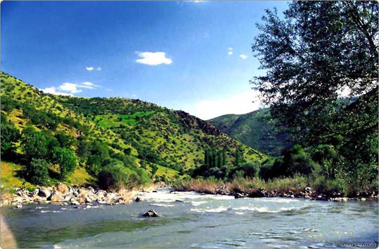 |
| Atrek River valley near Quchan, Khorasan Razavi. Image credit: Itto |
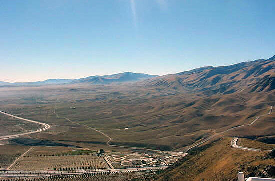
Old Parthava (Parthia) can be divided into two sectors; the northern slopes of the Kopet Dag and southern slopes. Parts of the northern slopes and plains are in today's Turkmenistan and are generally more arid than the southern slopes and valleys which are in today's Iran.
While arid, the northern Kopet Dag slopes and adjacent plains have since ancient times supported a thriving agricultural community and its farmlands have been watered by ancient canals. It is in this section that the ancient towns of Anau and Nisa were located.
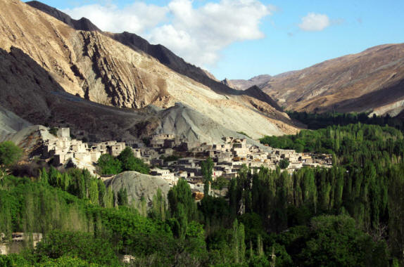
The southern Kopet Dag slopes of Parthava have more vegetation than the northern slopes. The southern slopes and the plains at their base are what Greek writers call the Parthian homeland. Parthava expanded southward and its heartland soon included a greater part of the river Atrek's upper valley and the kuhistans (hill areas), over the Kopet Dag peaks and into the fertile southern valleys. One of these fertile valleys if formed by the upper reaches of the river Atrek, a river that in its lower reaches passes through grass lands inhabited by the nomads of Dahi country and while the same time forming the border between the settled south bank of Varkana (Hyrcania) and the more nomadic north bank of Dahi country - before flowing into the Caspian Sea - the Darya-e Mazandaran. With changing climates, the grasslands and deserts on both sides of the lower Atrek are on the increase.
The entire region produces much grain, and the upper Atrek valley has been famed through history for its vineyards and fine wine.
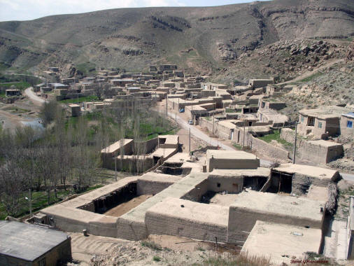
Today, Quchan (Kuchan), is a principal city in the upper Atrek valley, and there are ancient ruins scattered in its surrounding district. The Quchan region is earthquake prone. In 1893, 10,000 people perished in a devastating earthquake and the entire city was moved eastward. About 8 km west of modern Quchan, is a town called Shahr-e Kohneh meaning ancient city. The name Kohneh meaning ancient may give us a clue about its age.
Today, most of the Quchan city's inhabitants are modern descendants of Kurds relocated from the west by Shah Abbas I in the 17th century. Shah Abbas engineered the relocation in order to defend the Iranian plateau's north-eastern flank against Turkic raids. The Iranian portion of the Kopet Dag mountains is also called Daman-e Kuh.
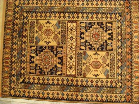
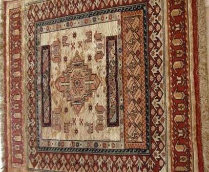
Quchan produces excellent carpets many with the boteh motif that we find common throughout Iran and the Aryan lands. The settling of Kurds in the area during the reign of Shah Abbas introduced added design elements in the region's carpet designs.
A minority of the Parthava region's inhabitants are still semi-nomadic or permanently nomadic. The semi-nomadic leave their village homes during summer to live in tents while moving their flocks to fresh grazing lands on the upper hill slopes. Unlike the nomads of the northern grasslands, an entire village does not move - just the herders. This life-style was quite common amongst Iranian-Aryans who lived in mountainous areas and mountain valleys (also see our page on the semi-nomads of Meymand). The semi-nomads return to urban dwellings for the winter. The permanent nomads have no fixed address and move their entire house and belongings on the backs of camels and horses. Today, both the semi-nomadic and nomadic lifestyle is vanishing and with it a heritage.
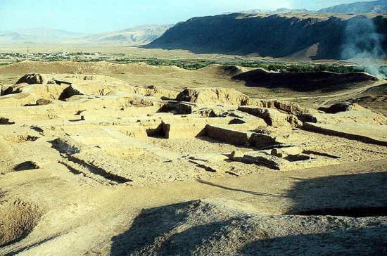 |
The Nisa valley and Kopet Dag hills from the ruins.
Image credit: Parthia.com |
 |
Turkmenistan landscape near the capital Ashgabat
Image credit: Travelpod |
|
References
Kar. The Kārnāmak-i Ardeshir-i Pāpakān / Kārnāmag-ī Ardashīr-ī Babagān, Book of the Deeds of Ardashir son of Babak / Babag. The extanct Karnamak has descended from a copy made by Rustakhm-i Mihraban. It also contains first reference to chess in literature.:
- at CAIS and at Iran Chamber, as translated in The Sacred Books and Early Literature of the East, (New York: Parke, Austin, & Lipscomb, 1917), Vol. VII: Ancient Persia, pp. 225-253. Charles F. Horne, ed.
- at Avesta.org translated by Darab Dastur Peshotan Sanjana, B.A., 1896.
- transliterated text at Titus
Jus. Marcus Justinus (3rd cent. CE) in Epitome of the Philippic History of Pompeius Trogus, translated by the Rev. John Selby Watson (London, 1853).
Isi. Parthian Stations (Mansiones Parthicae) was written sometime between 29 and 1 BCE. It lists all the supply stations, that is caravanserais maintained by the Parthavi (Parthian) Government for the convenience of merchants travelling along the caravan trail from Antioch, today a Mediterranean port in the southwest corner of Turkey, to the borders of India. With liberation from Macedonian rule, the Iranian-Aryans once again asserted control and facilitated trade along the Silk Roads.
Str. Strabo (ca. 63/64 BCE - 24 CE) Geography, translated by H. C. Hamilton, Esq. and W. Falconer, M.A.
Pol. Polybius (c 200-118 BCE) The Histories, was a Greek historian of the Hellenistic Period whose book covered history of the period of 220-146 BCE
Additional reading: » The Seven Great Monarchies, Vol. 6, Parthia by George Rawlinson
Parthava Pages:
Related reading:
» Top
|
